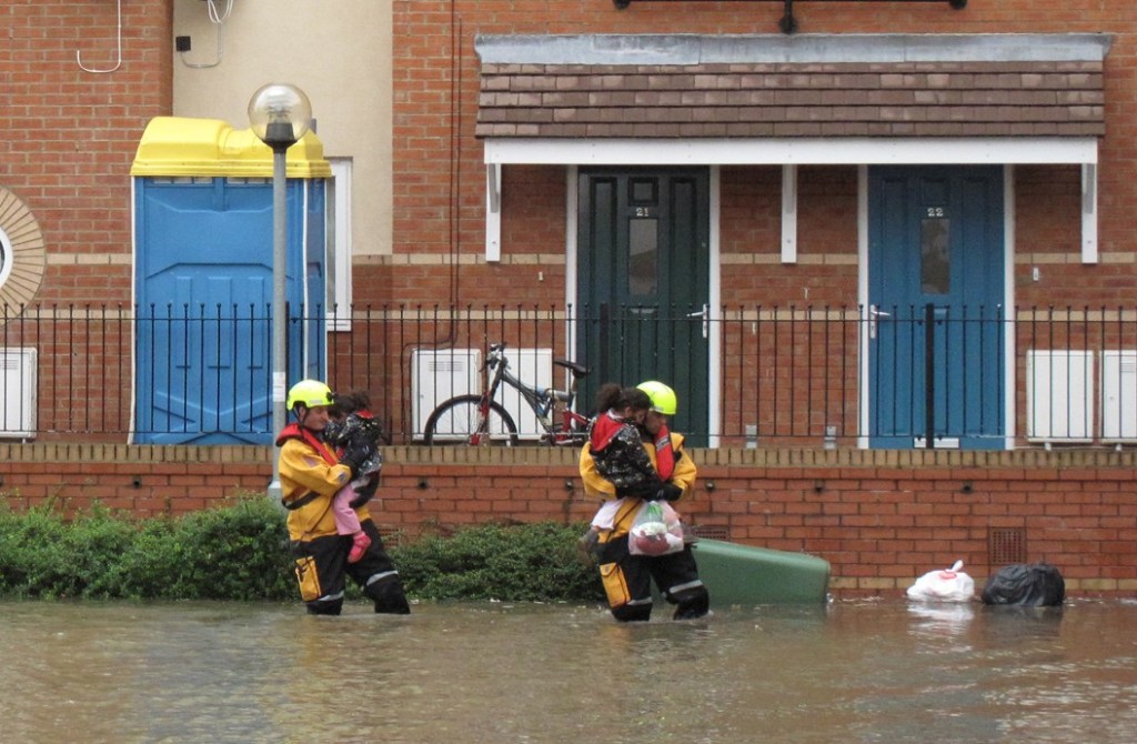
Plans to create a new home for Oxford University’s Engineering Department at Osney Mead are being watched very closely by OFA. Oxford University Development is bringing forward a proposal for the new building because of severe constraints at the sites the department currently occupies.
Alongside plans for the building itself OUD has been tasked by the City Council with producing a set of ‘principals and procedures’ to guide the further redevelopment of Osney Mead. A representative of OFA has taken part in two stakeholder workshops and we have submitted comments on the plans.
The planning application will have to be based on current flood risk as the Oxford Flood Alleviation Scheme is not yet in place. Some statements made in the consultation materials, and at the second stakeholder workshop, have concerned us and we sense the OUD team is struggling to find a way to deal with flood risk associated with the site. We have made a written submission to OUD on this and have raised concerns with the Environment Agency.
One of the principles proposed by OUD says: ‘Redevelopment of Osney Mead must put flood resilience first and foremost. Sustainable development must recognise the effects of climate change and build responsibly. A considered and responsive flood mitigation strategy across the whole site should drive any masterplan.’ We welcome this commitment, but the question is how to achieved it, and what implications flood risk has for various ambitions for the site. Even after OFAS is built there will still be some residual flood risk. We expect to engage with OUD in detail on this.
Information about the proposals can be found on this dedicated Osney Mead – OUD website.