Osney flood awareness event

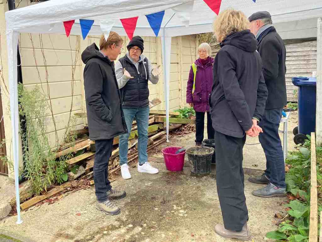
Oxford Flood Alliance held a flood awareness event on Osney Island on 16 November. Richard Thurston (who organised the event) and Simon Collings were on hand for two hours in the morning to talk to local residents about flood risk, protecting properties, and anything else flood related. We interacted with lots of neigbours, some well prepared for floods and some newcomers to the community considering options for protecting their homes.

Our aim was to encourage people with products like pumps, flood gates and airbrick covers to check they know where they are, how to install them and in the case of pumps, test they work. Several people told us they were doing this and we were able to test a pump for one resident.

This was the first time we have organised an event of this kind. The response was good and we plan to hold a similar event next year.

Richard Thurston demonstrating how a submersible pump works

Groundwater flood resilience South Oxford

Project Groundwater is seeking views from people in South Oxford who have experienced groundwater flooding. The insights of local residents will help the project understand how resilient the community is currently and what might be done to make it more resilient. The survey questionnaire can be found here. People who respond have the chance to qualify for a free flood resilience survey. It is open to residents in New Hinksey and Grandpont. There will be a public drop in at South Oxford Community Centre on 20 November, 4-7pm.

OFA has been working with Project Groundwater in helping set up a flood action group in South Oxford. The project is a government funded initiative managed by Bucks County Council which is working with a number of communities affected by groundwater. It has published 7 podcasts so far, most recently on insurance and on natural flood management techniques, which are worth a listen.

Keeping streams clear of obstructions

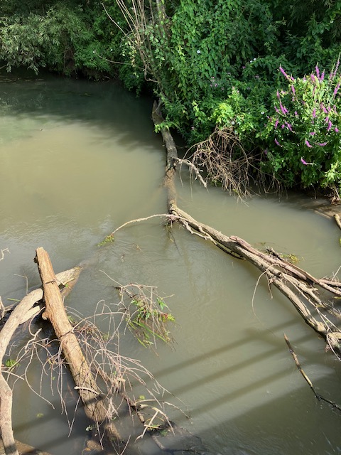
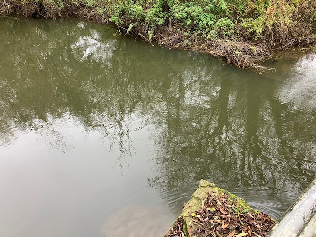
The fallen tree in the Bulstake Stream reported to the Environment Agency in August by OFA was removed by their maintenance team in September. Here’s what the stream looked like on 30 October.

The Environment Agency has an annual programme for maintaining sections of main river where a blockage could increase risk of property flooding. Riperian landowners are responsible for maintenance on other waterways.

If you’re concerned about fallen trees blocking a river please report it and we’ll try to get the issue attended to. Please supply photographs and the exact location of the problem. A resident in south Oxford recently succeeded in having a tree removed from Weir’s Mill stream by a local landowner’s estate management agent. The Environment Agency wrote to the managing agent in support of the request.

A423 bridge granted planning consent

Oxfordshire County Council has granted planning permission for the planned replacement of the Kennington road bridge on Oxford’s southern bypass (A423). The bridge lies on the route of the Oxford Flood Alleviation Scheme and work needs to commence on replacing the bridge before construction of the flood scheme can begin. The granting of planning approval for the bridge is another step forward towards the realising of the flood relief project which itself secured planning consent in July this year.

Structural problems with the A423 bridge were first identified in 2019. Details of the planned replacement can be found here.

Tracking future biodiversity trends

As part of OFA’s commitment to improving biodiversity in the west Oxford floodplain, steering-group member Simon Collings has been recording butterflies in the area. In 2023 he carried out a survey of species present in the floodplain and shared the results with the Environment Agency ecologists working on the Oxford Flood Alleviation Scheme. This year (2024) Simon set up a transect under the UK Butterfly Monitoring Scheme (UKBMS) . He and two volunteers conducted weekly surveys from April to September. Results have been shared with the EA.

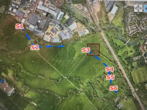
The 1 km transect route starts on the Electric Road near Osney Mead, follows informal paths across the meadow to the south of the Bulstake Stream, and finishes at Hogacre Eco Park. The route was planned with the directors of the Eco Park, and with the EA ecologists.

Why is OFA doing this?

‘The idea was to establish a baseline prior to the EA building the flood alleviation scheme,’ Simon explains. ‘I knew from surveying in 2023 that Hogacre is relatively rich in butterflies. The Hogacre trustees are keen to gather more data on biodiversity at the site and the formal methodology of the transect helps provide some of that. The first three sections of the transect, in contrast, are across land where the EA will be introducing improved species-rich grassland, hedges and trees. Over time the butterfly population here should increase.’

This year has not been good for butterflies, with numbers down hugely across the UK. This is reflected in the results obtained locally compared with Simon’s observations in 2023. A total of 161 butterflies, representing 18 species, were recorded along the transect. Of these 122 (76%) were in the scrub and meadow at Hogacre. The most commonly recorded species were meadow brown (48) and gatekeeper (45).

How does it help improve biodiversity?

The transect methodology gives a measure of relative abundance which can be compared with other sites and which can be tracked annually to show increases or declines in populations and species. Butterflies are highly sensitive to changes in the environment and for this reason are used nationally as an indicator of environmental health.

Surveying on the transect uses a precise methodology and the records submitted to UKBMS are checked by an expert. Simon’s 2023 sightings were submitted to iRecord where again records are verified by experts.

‘OFA sees the biodiversity elements of the flood alleviation scheme as an opportunity to support wildlife in the area,’ Simon says. ‘To maximise this we want to engage local people in citizen science and conservation activity, working in partnership with the EA.’

Landowners in the area, including some Oxford University colleges, are already involved in floodplain-meadow restoration. There are a lot of resources in the city to draw on. OFA believes we could create something significant here which connects up with other biodiverse areas in the county. The river system is an obvious wildlife corridor.

Simon is a member of Butterfly Conservation and also records on a 4.5 km UKBMS transect at Wytham run by the Centre for Ecology and Hydrology. More information on butterflies at Hogacre can be found here.

Catchment saturated after record rain

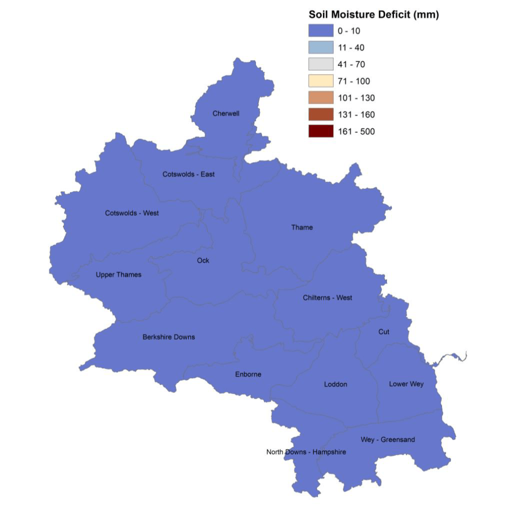
The Environment Agency has issued a report giving details of the exceptional rainfall in the Thames catchment in September and the consequences of this. It makes sobering reading. The capacity of soils to absorb more water has been reduced to virtually zero resulting in high river flows. The rising chalk groundwater aquifers are untypical for this time of year.

The report summary says:

Thames area received 193mm of rainfall in September, 317% of the long term average (LTA); making it the wettest month since records began in 1871. Following the high rainfall, soil moisture deficits (SMDs) were reduced to zero and this resulted in high effective rainfall of 50mm (LTA is 5mm). Monthly mean flows increased at all our sites and 4 measured their highest ever September flows since site records began. Due to the heavy rainfall, the seasonal declining trend of groundwater levels reversed at the majority of our indicator sites in September, which is earlier than normal.

This map of soil water deficit (i.e. the available capacity in the soil to absorb more moisture) shows the situation graphically. The long term average is 88mm meaning we typically enter winter with some capacity in the system to absorb rainfall. Not this year,

This is Flood Awareness Week. If you’re concerned about potential flooding there is good advice on the government website about how to prepare for and protect against flooding. The EA report is the Monthly water situation report: Thames Area.

Flood Action Week 2024

Next week, 14-20 October, is Flood Action Week when the government will be raising awareness of flood risk and what we can do about it. Being prepared for flooding will reduce the impact, even if you only do a few basic things. Making your home flood resilient can, the government says, reduce the costs of repairs by up to 73%. Advice about what to do if you are at risk of flooding is available here.

Apart from protecting homes and businesses look out for flooding on roads and don’t drive through flood water. Most of those who die as a result of flooding in the UK do so because they tried to drive through a flood. Don’t chance it.

Take steps now to make sure you are as prepared and protected as possible.

BBC urges flood preparedness

BBC One this morning (2 October) re-broadcast a feature on flood preparedness featuring OFA streeing group member Adrian Porter. The story was first aired in July 2023 to raise awareness of flooding and the need for households and businesses to be prepared. This time the item focused on what it’s like to be flooded, using Adrian’s reflections from 2007, and then switched to someone being rescued from a flooded vehicle by Oxford Fire & Rescue.

After record levels of rain on 23 September the catchment has limited capacity to absorb more water, and it will take time to drain. Further storms could cause the Thames to rise more quickly than we’ve seen over the last week. As we head into winter we all need to be prepared.

Adrian Porter on BBC One, Morning, Live 2 October 2024

Further update on flood alert

The Environment Agency updated it’s flood alert for the Thames and tributaries in the Oxford area this morning. The update reads as follows:

Property flooding is not currently expected.

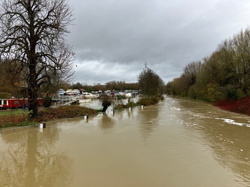
River levels are high on the River Thames as a result of heavy rainfall. Therefore, flooding of low lying land and roads is expected to continue today, Saturday. Today is expected to be dry. Sunday will start out dry followed by rain in the afternoon. We expect river levels to remain high over the next 24-48 hours as water moves downstream.

We are monitoring the situation. Our staff are managing weirs on the River Thames to reduce flood risk. Avoid using low lying footpaths near local watercourses. Go to the ‘River and Sea levels in England’ webpage for current river levels. This message will be updated tomorrow morning (29/09/2024), or as the situation changes.

Symposium delegates visit South Oxford

Around 30 delegates to a British Hydrological Society (BHS) symposium in Oxford took part in a field trip to South Oxford on 24 September. Oxford Flood Alliance member Simon Collings, Richard Harding of the Environment Agency and David Macdonald, hydrogeologist and South Oxford resident, co-hosted the visit, which they helped design.

The delegates had spent two days discussing developments in flood modelling and forecasting in the UK and internationally. Predicting the impacts of flood hazards is complex and takes into account many elements. These include the nature of the catchment, the ground conditions, groundwater levels, surface-water runoff, volume and intensity of rainfall, and sewer infrastructure.

Researchers are working to improve our understanding of each of these components and build integrated models to help better represent what happens during an event. The field visit provided an opportunity to learn about a specific flood-affected community, the measures being taken to reduce flood risk, and to think about the future application of some of the monitoring and forecasting tools presented at the symposium.

One topic of discussion was groundwater monitoring. In South Oxford this is currently very limited, with scope to improve data collection and potential benefits in using river data to indicate the likelihood of groundwater-related flooding. Some work is about to start on this with support from Project Groundwater, a government-funded initiative aiming to fill some of the gaps in our understanding of groundwater flooding. OFA is currently working with Project Groundwater to set up a flood group in the South Oxford area.

Abingdon Road 7 January 2024