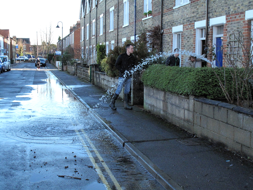
Protecting individual properties from flooding, and enabling those which do flood to recover quickly, is still in its infancy in the UK. Few companies make and sell flood-protection products, and few builders know how to make a house or business flood resilient. The new BeFloodReady centre at Wallingford, which launched in May, aims to change all this. Four members of the OFA Steering Group went to see what the centre might offer those of us at risk of flooding.
It’s an impressive set up, with a teaching room and a series of flood-resilient rooms which are used to provide accredited training to professionals. There are two reception rooms, a bathroom and a kitchen (pictured below), all of which can be filled with water. The rooms have a variety of floor coverings and types of wall construction to simulate different scenarios. They are used to demonstrate how a flooded property can be dried out and restored quickly, given the right equipment and processes.

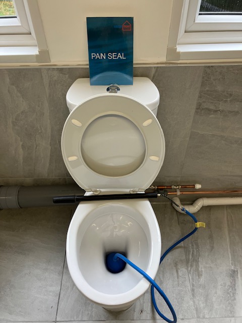
In the teaching area there is a display of different types of flood barriers, air bricks and air-brick covers, flood-resistant doors, and other products. Some items, such as doors, are expensive, but a simple device like a lavatory bung (pictured below), which can prevent sewage flooding your home, is easily affordable.
As well as providing practical training, the centre has developed a series of standards for the design, installation and maintenance of property-level resilience measures. This work is led by Graham Brogden MBE, who spoke at OFA’s tenth annual public meeting back in 2018. Graham was working for Aviva then and talked about how insurers were starting to pay much closer attention to property-level flood resilience.
During our visit Graham talked us through the code which has been created to standardise Property Flood Resilience (PFR) measures across the country. Over time this should help raise the quality of service property owners receive from professional providers of flood protection. The code provides property owners with a standard against which to evaluate anyone offering advice and services in this area. This short video explains the approach: https://www.youtube.com/watch?v=4sZv6Z3O8BA
Graham showed us an online platform, based on the code, which can be used by professionals to capture data on individual properties, inform the design of solutions, and enable monitoring of their effectiveness. The platform, developed by Resilico, also has a free app which householders can download to their phones. This provides flood alerts, including warnings of surface-water flooding, and includes a template for creating a bespoke flood-preparedness plan for your home or business. You can even set up reminders to periodically check that equipment like pumps and flood gates are in good working order. Search your app store for ResilicoConnect.
The insurance industry is increasingly focusing on the adoption of Property Flood Protection measures with Flood Re due to phase out in 2039. ‘Flood Re has already started its transition plan,’ Graham told us, ‘and this heavily relies on properties being made more resilient to flooding, using both resistant and recoverability measures, to help reduce the impact flooding can have on a property. They have also recently introduced the Build Back Better scheme, which a number of insurers have signed up to. This means that when a property floods Flood Re will provide an additional £10,000 on top of the repair costs to help make the property more resilient for the future.’
Even with the Oxford Flood Alleviation Scheme in place, there will be homes and businesses in Oxford that remain at some level of flood risk. For those properties, flood resilience will remain important and the Wallingford centre will be a useful resource. If the flood scheme is built the number of properties which remain at risk will be much reduced. This will mean that targeted interventions to improve property-level resilience for those communities still needing protection could be feasible.
The BeFloodReady centre is the UK’s first dedicated facility to deliver accredited training. It is funded by Defra as part of the government’s PFR Pathfinders programme which aims to increase knowledge and skills in the building and insurance industries around property flood resilience. OFA visited the centre on 5 July 2023. For more information visit: https://www.befloodready.uk/