
The diagram shows why Oxford floods, and the photo from 1947 why something needs to be done to reduce the risk. Although measures have been taken since 1947 the risk remains high and climate change may well make things worse.
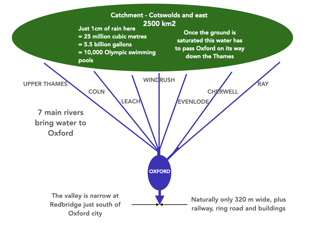
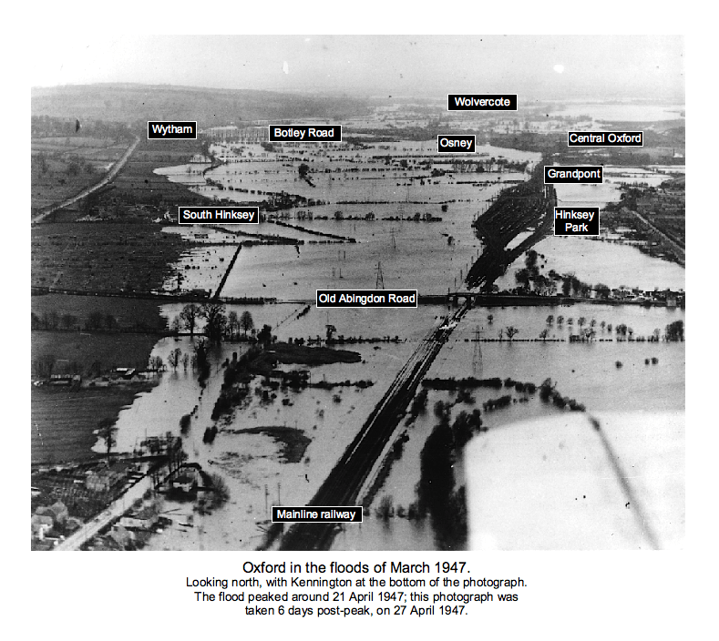
The diagram shows why Oxford floods, and the photo from 1947 why something needs to be done to reduce the risk. Although measures have been taken since 1947 the risk remains high and climate change may well make things worse.
The Environment Agency is replacing the weir on the River Thames, located next to the Trout Inn at Godstow, in Oxfordshire. They say (our bold emphasis):
“We will remove the old weir structure and build a new weir, two metres downstream. This will allow for better debris clearance. For the last year we have been working on the detailed design of the new weir and applying for funding.
The weir will look largely the same, as we will be using the same design of gates. There will be an additional structure to the left (looking upstream) which will allow fish and eels to make their way up river.“
The full briefing is here.
We understand that an update on the search for an environmental partner for the Oxford Flood Alleviation Scheme (the Scheme) is likely to come soon.
We have all along pressed to see the best possible done environmentally: having an expert partner to help manage the environmental aspects of the Scheme, while at the same time maintaining it for its purpose of flood relief, over the decades ahead, seems the ideal way.
Floodplains, with their meadows and wetland areas, are a valuable, and increasingly less common, habitat, demanding expertise to manage them well. So we’re waiting expectantly to learn what’s been happening.
