Botley Road area meeting

13 September 2010

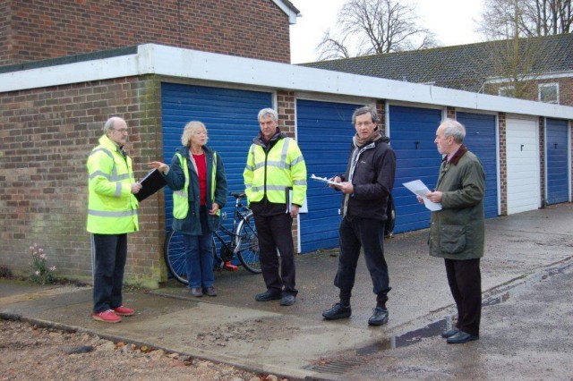
We met with representatives of the EA, and both Oxford City and Oxfordshire County Councils last Friday, 10 September. We were shown the latest results from the computer model of flooding in the Botley Road area, developed by the EA in collaboration with City Council engineers. The effect of various interventions has been investigated.

The model suggests:
1. The existing Bullstake Close barrier, erected by the City Council to protect its properties there, will provide flood protection to properties to the south of the Botley Road at least to a 1 in 25 year flood level (the worst of the floods in recent years, in 2007, was about that level).

2. Creating a road hump at the north end of  Earl Street would protect the street from inundation (ie becoming a river) up to the same level. This will be done, by the County Council. The street will have to be closed to traffic throughout the work – the County will be consulting with residents about this. While there will inevitably be temporary inconvenience while the work is done, the benefits in flood risk reduction will be very well worth it.

3. A barrier across the alleyway in Duke Street would give further protection to Duke and Earl Streets, from floodwater coming from the Bulstake Stream behind the houses on the east side of Duke Street. The County hope to do this work, subject to discussions and agreement with the owners of the adjacent houses.

4. Floodwater would still be able to enter the rear of properties on the east of Duke Street direct from Bulstake Stream as it has in the past. – and not only flood those houses but then move on to flood people on the other side of the street and in Earl Street. This could be remedied in various ways – ranging from a permanent earth bank (bund) along the gardens of all the houses backing onto the stream, to individual house measures such as flood doors and airbrick covers, to sandbags. Please note that residents will be fully consulted about the options and that action can and will only be taken if people agree. It seems unlikely that everyone would agree to a garden barrier (and it would have to be in every garden without a break for it to work of course) even though this would give the best protection. Individual house measures on the other hand might a very different matter as they would protect the house itself first and foremost. It is possible (not certain) that money may become available to help householders buy the necessary protection. There’d need to be a community plan for placing protection if people were away or for any other reason unable to do it themselves when flooding threatened.
OFA will be working with the EA and the CIty on this. At last Friday’s meeting we suggested that maybe the EA come to our OFA annual Public Meeting – which will probably be in November – to present the options to residents and get their reactions. This isn’t decided on yet but may well happen.

5. Lowering the highest part of Lamarsh Road would not confer further benefit in a 1 in 25 year or smaller flood. Beyond that it is not clear how much benefit it might provide. The cost of lowering is now said to be £500,000. We are sceptical about that remarkably round sum: it has gone up and down like a yo-yo over the weeks – as low as £200,000 not long ago. OFA believes that there should be further consideration, that we should perhaps talk directly to Kingerlee, and that we should try to ensure that roads are built so as to allow the work to be done later even if it is not done now.

Lamarsh Road plan – urgent!

18 August 2010

We met the EA recently about the proposal to make Lamarsh Road the route for flood water rather than Earl Street. Further modelling has been done by the EA but was not completed when we met. The modelling continues and we have asked this week for an update.
Our concern is that the model, on which decisions will be based, is completed, and a decision made, before the deadline of Kingerlee starting work on their site. Kingerlee are very cooperative but understandably have to proceed with their own work.
Our MP, Nicola Blackwood, is strongly supportive – but she too awaits a clear plan before she can make representations about funding.

We hope the EA will produce their advice in time. This has been under discussion for many months, it  is high time we had a clear opinion, advice, and a plan as appropriate, from the EA.

Reducing the Risk of Flooding of Earl and Duke Streets and Bullstake Close

21 July 2010

The following is being circulated as a flyer to residents of Earl and Duke Streets and Bullstake Close. Links are being emailed to our supporters.

Update from the Oxford Flood Alliance (OFA) on Progress in Reducing the Risk of Flooding of Earl and Duke Streets and Bullstake Close; July 2010

It is 3 years since the severe floods of July 2007, so it seems a good moment to report on progress made since then, but also to highlight a further project that requires the most urgent and determined action. OFA has worked hard, since November 2007, to make sure things have been done and we continue to do so.

How these streets flood

Earl and Duke Streets flood by a combination of water coming up through the ground, water coming up through the drains and water which arrives over the surface. Bullstake Close floods by surface water.

What has been done

Bullstake Close:
Oxford City Council built a wall around part of Bullstake Close to protect it from surface water arriving from north of the Botley Road. DONE, 2009

Earl and Duke Streets:
the Bullstake Close barrier will hold back flood water until it is overtopped. DONE, 2009

Thames Water and Oxford City have installed special valves which, when flooding threatens, can be closed to isolate the drains in Earl and Duke Streets from other local drains, taking the pressure off them. DONE, 2009

there are permanent pumps in Earl Street, installed by Oxford City (?) to pump accumulating floodwater away into the floodplain to the south. DONE, 2004

the gullies in the street have been altered so that that all now feed into the pumps, so enabling the pumps to work more effectively. DONE, 2010

a culvert has been installed by Oxfordshire County Council at the end of Duke Street and out into the floodplain to the south. This is to provide a route out for water running down Earl Street from the Botley Road. To streamline the flow of this water the pavement has been rounded off where Earl Street connects via an alley into Duke Street. DONE, 2009

a road and pavement hump built by Oxfordshire County Council across the Botley Road end of Earl Street to stop floodwater flowing down the street (until it is overtopped). PLANNED FOR 2010

a barrier across the path leading into the southern end of Duke Street to prevent water flowing into the street from Bulstake Stream which it has done in the past. UNDER CONSIDERATION

the City Council has suggested that residents at the southern end of the east side of Duke Street might like to consider property level defences for their houses. Property level defences means floodgates for doors and sealing off airbricks. If everyone got together and did this, this would make a barrier to stop water flowing into and through these houses from Bulstake Stream. This would directly protect the individual houses and, indirectly, their neighbours. It is possible that grants may be available to help with the costs of this, though current cuts mean this is uncertain. RESIDENTS WILL DECIDE WHETHER THEY ARE INTERESTED.

last but not least, providing an alternative route for floodwater in the Botley Road to get away downstream to the south. In the past it has flowed down Earl Street like a river. The alternative route proposed is down Lamarsh RoadUNDER ACTIVE AND URGENT CONSIDERATION.

Our response to the EA on their proposals for further short-term measures for Oxford

14 July 2010

Oxford Short Term Measures 2

Thank you for asking for comments on your proposals. Here are ours:

Willow Walk – fine.

Hinksey Stream – welcome. We hope the work will include removal of the trees which seem to be actually in the stream upstream of the bridge.

Wareham Stream – we think that it is hardly worth maintaining the stream if the sluices are not renovated. Both inlets from Castle Mill Stream are useless, and the sluice at the brewery is not operated. Therefore in a flood there is not much flow.

Other ideas
We are disappointed that other, more ambitious, options were not pursued. We believe there are many things in our document “Building on Success – Suggestions for medium-term measures to further reduce the risk of flooding in Oxford and the surrounding area” launched this March, which would be well worth doing and we look forward to discussing them with you soon.

Lamarsh Road
In the meantime, our top priority remains to achieve a new flood route via Lamarsh Road in the now very limited time available. We understand that you share this wish and are working hard at it, which we appreciate. For now we would rather achieve this than anything else, as we made plain at our meeting in South Hinksey in March. If funding is not possible in any other way then we think money should be diverted from one or other of the Short Term Measures 2. They could be done later, whereas Lamarsh can’t.
It would be dreadful to fail to implement the Lamarsh scheme. Doing so, on the other hand, would be a great success and improve the lot of many people who have been flooded repeatedly and remain at high risk.

Oxford Flood Alliance, July 13th 2010.

Earl and Duke Streets, Lamarsh Road – and the role of the County Council

20 June 2010

The City and the Environment Agency have worked hard on the technical assessment of feasibility, which they have completed. This shows that our plan would work.

We now urgently need detailed costings of the work required to lower the southern end of Lamarsh Rd. We are looking to the County to provide these. At our meeting in South Hinksey on 24 March 2010, attended by senior representatives from all the agencies concerned, the County Council made a commitment to assess what services lie below that part of the road and to prepare detailed costings of the work that would be needed. This might include digging a test hole. So far as we can discover this has not been done in the intervening 11+ weeks. Considering the urgency, this is extremely disappointing.

We hope that this work will now be done with the utmost urgency.

Go to Library to download our Lamarsh Road proposal and how it would bring relief to the many people whose homes have suffered repeated flooding.

Nicola Blackwood MP visits Earl Street

10 June 2010

Nick Hills, Richard Thurston and Peter Rawcliffe of OFA met our new MP for Oxford West and Abingdon, Nicola Blackwood, in Lamarsh Road on Saturday 5 June. Nicola came to see and hear for herself about the severe and recurrent flooding of about 60 homes in Earl and Duke Streets, the reasons for it – and what OFA has proposed to reduce the risks of further flooding here.

We are delighted that Nicola has said she will support this initiative which could bring relief to many households. She is writing to the Environment Agency asking for details of the cost/benefit analysis, which is currently under way, as soon as it is completed. She will then help us to press for funding and urgent action with the three authorities involved: City, County and Environment Agency.

Hinksey Stream cleared

30 January 2010

The OFA Flood Blackspot of July 2009 was the Hinksey Stream from North Hinksey to Redbridge, which badly needed clearing. This has now been done by the Environment Agency. It is very much better. Thank you!

Flood scheme postponed

22 December 2009

At our meeting with the EA on 8 December we were told that the 100-year flood protection scheme for Oxford had been postponed indefinitely: see EA End of Year Update, 2009.

While disappointing it is not a great surprise: we have always been doubtful whether this scheme would ever materialise. That is why for two years we have pushed, successfully, for action NOW.
We will continue to press for early action: there are 8 or 10 further measures across our area which, at modest cost, could significantly reduce flood risk, by helping to restore the floodplain to its proper function, keeping water flowing through rather than accumulating. This should help to keep people dry from all but the most extreme events. The Environment Agency of course shares this aim. We will continue to work closely with the Agency; we believe we need to define a new Medium-term Flood Strategy for Oxford. We will be looking to our politicians, both locally and nationally, to ensure that the necessary works are fully funded, so that the serious threat facing thousands of homes and businesses in Oxford is reduced. We have begun to formulate our response. We will have decided how to proceed by the second or third week of the new year.

Site meeting, West Oxford Inter-Agency Working Party

At this morning's meeting, from left to right: Nick Hills (OFA), Susanna Pressel (City and County Councillor), Keith Lead (Environment Agency), Paul Kirkley (Oxford City Council) and John Copley (Oxford City Council). Also present were Steve Smith (Oxford City Council) and (taking this photograph) Andy Webber (OFA).

At this morning’s meeting, from left to right: Nick Hills (OFA), Susanna Pressel (City and County Councillor), Keith Lead (Environment Agency), Paul Kirkley (Oxford City Council) and John Copley (Oxford City Council). Also present were Steve Smith (Oxford City Council) and (taking this photograph) Andy Webber (OFA).

7 December 2009

A site meeting this morning successfully settled the operational details for the new flood wall and associated sandbag wall at Bullstake Close. Who will monitor flooding at the wall and the criteria for maintaining or reducing the sandbag wall have been agreed.

Operation of the Penstock valves installed recently by Thames Water, to protect the drains of Earl and Duke Street from inundation from north of the Botley Road, was similarly considered and agreed.

Personnel from Oxford City Council will be given the necessary training for carrying out these operations.

A written plan will be prepared.

Climate change and OFRMS

1 December 2009

Appalling news from Cumbria. A policeman loses his life. Water 8 ft deep in Cockermouth, bridges and homes destroyed. A 1 in 1000 year flood we are told.

Major adverse weather events seem to be getting more common – global warming, whatever its cause, the alleged culprit.

Oxford, in a flood plain and permeated by watercourses, has no flood defences. Recent renovation of existing waterways, though welcome, will not prevent big floods.

The EA has come up with a plan to give Oxford protection against any flood up to a 1 in 100 year flood. It’s called the Oxford Flood Risk Management Strategy.

There will be concerns about some aspects of the plans. But surely the city of Oxford cannot afford to do without protection against what nature seems increasingly likely to throw down on us? The Environment Agency says that 3600 properties – 3100 dwellings and 500 businesses – could be flooded in an a 1 in 100 year flood. The nearest we have had to that in living memory was in 1947. This would dwarf the floods Oxford has seen in more recent years. 10,000 people could be flooded.