Earth Trust’s River of Life II wetland

The local environmental charity Earth Trust is one of several organisations providing advice to the Environment Agency about the biodiversity aspects of the Oxford Flood Alleviation Scheme. Their experience of introducing new wetland habitat on the Thames is an invaluable source of learning. This recent post on their website gives details of some of the early progress in their River of Life initiative, including data about carbon emissions.

This earlier post, from June, describes an innovative remote monitoring station (see photo below) which enables the Trust to gather data about the presence of various species in the project area – bats, water voles, birds, moths. Lessons from this initiative will be beneficial to the implementation of the Oxford Flood Alleviation Scheme and may help inform the way biodiversity gain is monitored.

Comments on City Council plans for Osney Mead

Oxford City Council has issued a draft Supplementary Planning Document for the development of the western end of the city centre, an area which includes Osney Mead. The council is inviting comment. The relevant documents can be found here: https://www.oxford.gov.uk/news/article/2217/council_invites_views_on_latest_stage_of_major_transformation_of_oxford_west_end_and_osney_mead.

Osney Mead floods and will continue to do so even after the Oxford Flood Alleviation Scheme is built. How flood risk will be managed as plans come forward will need very close scrutiny. OFA believes the SPD should be strengthened in a number of areas to set an appropriate framework for managing potential future flood risk, including from sewers. We also believe the approach to biodiversity needs strengthening in line with the approaches adopted by the Oxford Flood Alleviation Scheme. OFA has submitted the following comments to the City Council:

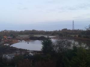
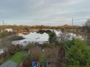
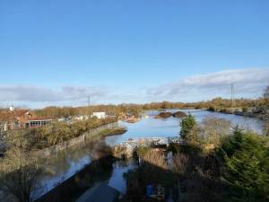
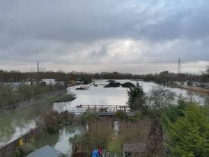
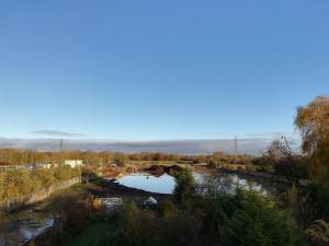
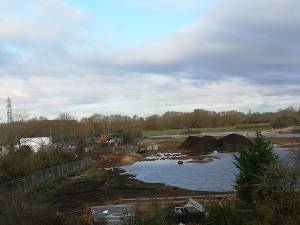
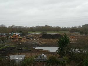
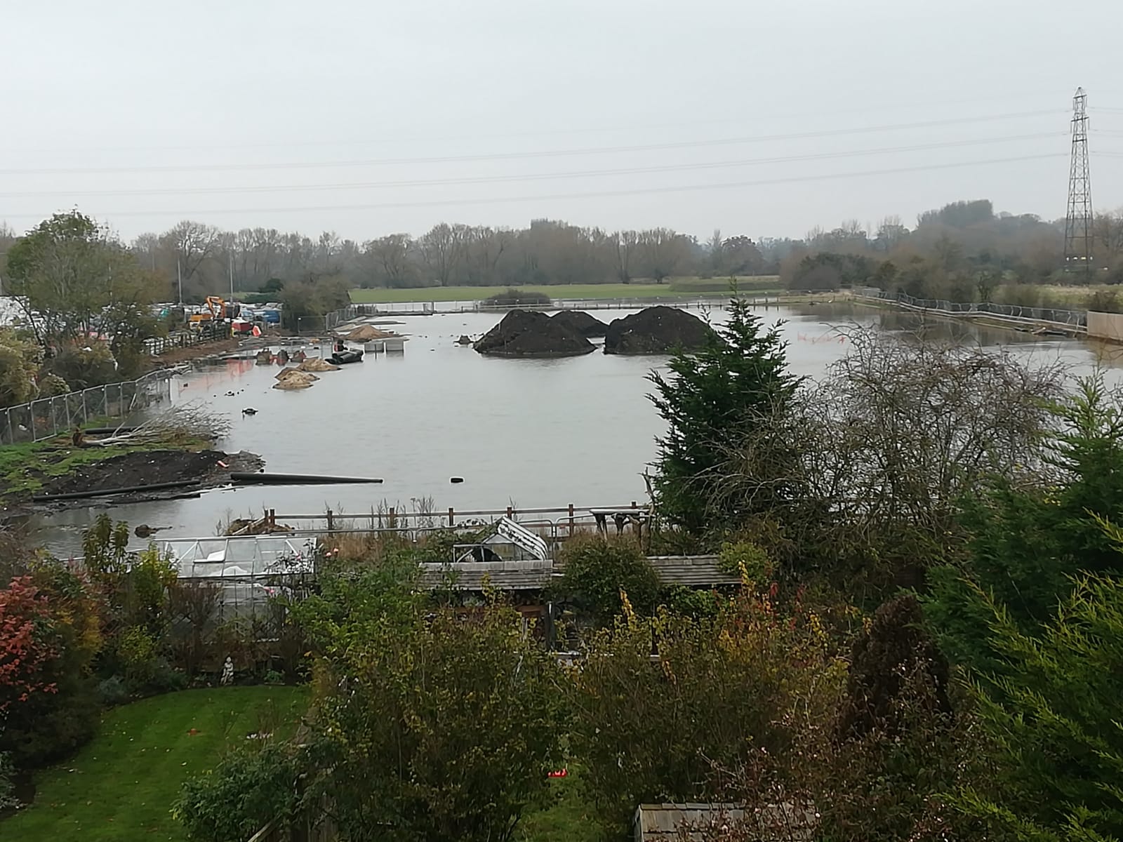
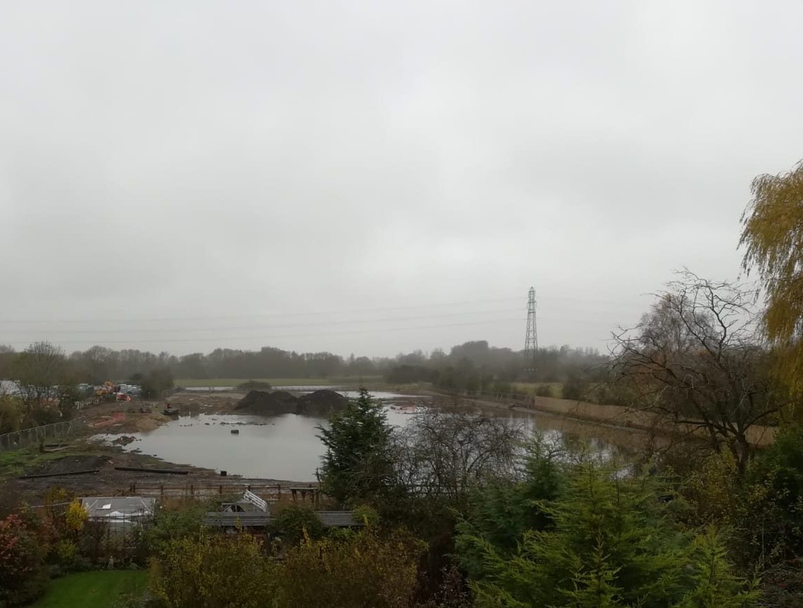
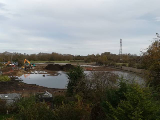
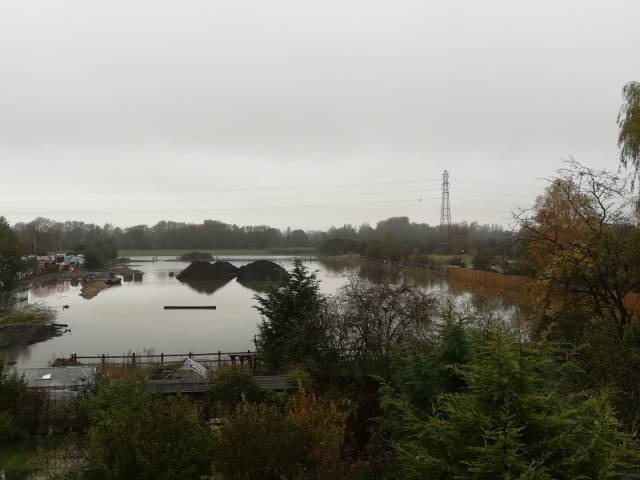
a) Flooding and flood risk – the documents acknowledge that Osney Mead floods and will continue to do so after the completion of the Oxford Flood Alleviation Scheme, and that any development there needs to create capacity to contain and manage flood water. This can only be done, the documents say, if the whole Osney Mead site is developed in a joined-up way. The documents also recommend the creation of the appropriate infrastructure before any other development. We strongly support this view. Management of flood risk needs to be taken very seriously in any plans which come forward, not just for Osney Mead itself but also for adjoining areas. There is a risk that piecemeal re-development of the site could increase flooding locally and it would be challenging to monitor and manage.

While we welcome the general statements made about flood risk we do not see how some of the descriptions and images of proposed redevelopment on Osney Mead are consistent with flooding of the area. We therefore have serious questions about how well flood risk has been understood by the authors of these documents. In particular, the documents talk about ‘activating’ the riverbank south of Osney Lock and down to Grandpont. The proposals envisage a new, wider cycle and pedestrian route along here, river-facing buildings (apartments, offices) and new spaces for people to sit. The illustrations of what this might look like show a heavily urbanised and landscaped river frontage with paths and building all at the same level. But the towpath floods most years and is often impassable. This is flood zone 3b, part of the natural flood plain, and the types of development permitted in such an area by the National Planning Policy Framework are very restricted.

How can the envisaged ‘activated’ frontage as illustrated in these documents possibly be realised in these circumstances? Will the bank be raised to create the kind of structures shown in the SPD? If so what happens to flood water which currently overtops the Thames banks and inundates adjacent areas? Canalising the Thames at this point would create significant flood risk for existing communities both up and downstream of the area. Or will the riverside path remain at existing levels and be allowed to flood? This is very unclear in the documents. We would like to see explicit statements in the SPD and design guidelines about the challenge of ‘activating’ the riverbank given that it is in flood zone 3b. Illustrations in the documents should also present a more realistic view of what the redevelopment might look like.

The design guidelines talk about new bridges connecting the towpath by the Punter to Barret St on the other side of the Thames, and one at the eastern end of South St crossing the Osney Stream to connect to Osney Mead. In both of these locations temporary flood barriers are currently deployed when river levels are high. These barriers are critical to preventing houses on Osney Island from flooding. At the end of South St there is a large wall where the proposed new bridge would come across. This wall helps to contain flood water in Osney Stream. The demountable flood defences for the island  are stored in the EA’s Osney depot. If this depot is to close and move we need to understand how flood defences will be deployed during a flood emergency. A large pump located on EA land behind the houses on the eastern end of South St is also a critical part of the local flood defence system. This pump evacuates flood water from the island and pumps it into the weir pool. Even after the completion of OFAS houses on Osney will continue to be vulnerable to flooding and temporary defences will still be required. We would like to see the SPD/design guidelines explicitly state that any developments must not compromise flood defences for Osney Island.

A holistic approach to redeveloping Osney Mead potentially creates an opportunity to help reduce flood risk to Osney Island as well as addressing the challenges of the Osney Mead site itself. We would like to see the SPD flag up this opportunity as something to be explored. We have a rare opportunity to reduce risk for vulnerable Osney residents and this should not be missed.

Redevelopment of the Castle Mill area could potentially affect streams and weirs in that section of the city. Any plans coming forward should ensure there is no reduction in the capacity of these streams to help move flood water through the city. Could the performance of these water courses be improved to help alleviate flood risk in the city? Has this been considered?

b) Sewers – the current sewer system on Osney Mead does not cope with floods and is quickly infiltrated by flood water. Sewage is pumped from Osney Mead up Bridge St on Osney Island to join the main sewer on Botley Rd. In a flood the pressure in the system means sewage bubbles out of the sewer covers and has to be pumped into the river. Some people on Osney Island cannot use their toilets during a flood. We raised this issue in a previous consultation but there is no mention of sewer infrastructure in the Supplementary Planning Document or the Design Guidelines issued for consultation.

We need assurances that adequate sewer infrastructure will be put in place and this must be a prerequisite for any redevelopment of Osney Mead. The increased density of proposed redevelopment will greatly increase pressure on the sewer system. Failure to address this infrastructure requirement could be disastrous for some Osney residents and would mean regular discharges of sewage into the local wate ways to the detriment of the wildlife. When we have tried to raise these issues with Thames Water in the past they simply say ‘it’s caused by fluvial flooding which is nothing to do with us’. We know what an appalling track record the water companies have on river pollution. A holistic approach to the redevelopment of Osney Mead must include addressing the sewerage problems, including using flood mitigation measures to reduce risk of sewers being infiltrated.

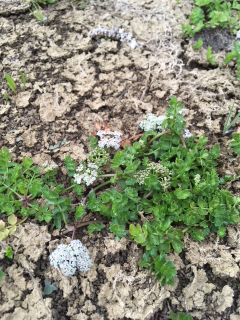
c) Biodiversity – throughout the development of the Oxford Flood Alleviation Scheme we have been strong supporters of the ‘environmental vision’ of the scheme and the idea of making the new stream as natural as possible. This helps reduce long-term maintenance of the assets being created and is far more sustainable than a more engineered approach. We believe a similar approach should be adopted for Osney Mead. The design document talks about ‘sensitivity to habitat’ and of retaining ‘existing trees where possible, especially those of good ecological and amenity value.’ A glance at Google Earth shows the two main areas of tree cover on Osney Mead are along the bank of Osney Stream opposite the houses in Bridge Street extension, and along the towpath south of Osney Lock down to the railway bridge. The SPD seems to envisage the elimination of all of these trees. This is a major contradiction in the documents. Removing them would take out most of the existing habitat. There is a considerable difference between the carefully thought through strategies in OFAS for how biodiversity will be enhanced through the project, and the vague reliance on street trees and green roofs in the SPD design document. Green roofs need regular maintenance including irrigation and addition of fertiliser. There are some positive words in the design guideline but protecting and enhancing existing biodiversity in the area, including incorporating wild, unmanaged space into the design, hasn’t been adequately thought through. Continuing to allow the river frontage to operate as natural floodplain as it does currently, with the trees and other wild vegetation retained, would be less environmentally destructive and cheaper to maintain. We would like to see approaches here better aligned with OFAS’s approach to enhancing biodiversity. The SPD should include explicit references to OFAS and its environmental vision, and alignment with this should be a requirement of any developments coming forward. The OFAS project covers an area which borders Osney Mead and includes important targets for new wild flower meadows in the area. Opening access into the greenbelt from Osney Mead must not compromise the biodiversity targets OFAS is committed to delivering.

Frozen

The Seacourt car park extension site has been pumped out for a few days following Storm Brendan which has brought huge amounts of water from our extensive catchment in the Cotswolds. But today the site is again filled with water, which has frozen overnight.

Seacourt P&R extension – further updates

Work began again briefly as mentioned in the last post. Water was pumped from the site into a ditch newly dug nearby and leading to Seacourt Stream.

River levels have now risen further. Pumping has stopped and the site is again abandoned.

Were it a car park it would be unusable of course.

This post will be updated periodically (see photos).

Work resumed on 7 January 2020. This latest flood was another 18 days, taking total flooding of the site this winter to 6 weeks 5 days. The prediction in the planning application was for 2 weeks a year. It remains to be seen how it averages out over a number of years.

Work resumed at Seacourt P&R today

Work resumed at Seacourt P&R extension today, 4 weeks and a day after it had to stop because the site had flooded. Here is the sequence from 11 November to today.

Update on Seacourt P&R extension

Following up on our post of the 15th about the Seacourt P&R extension:

First, a budget figure of £5,156,122 was approved by Council in February 2019. That’s the last official figure we know of.

Second, the area remains flooded as this picture from this morning shows.

Edit – still flooded 25/11/19.

A mistake

While we wait anxiously to see whether homes, businesses and roads will flood, work on the City Council’s extension to its Seacourt Park & Ride has come to a very wet standstill.

Building a car park in a flood plain is not sensible. Work having started as the wet winter season approached, the site is now a lake and work has stopped. The JCBs have been withdrawn onto the higher ground of the existing car park, and heaps of building materials are abandoned in the water. If the construction had been completed much of the extension would currently be under water. All this while the City is on ‘only’ a Flood Alert, the lowest category of concern.

The construction costs are likely to be much higher than estimated because of the disruption caused by flood events of the kind we’re currently witnessing. Councillors ignored the reality of frequent flooding here when they approved the planning application, and now we’re seeing the consequences. The last official budget figure we’re aware of was around £4million; we have heard, from a usually reliable source, that the cost may have risen to around £6 million, even before the present flooding of the site. Is this a sensible use of tax payers’ money?

Flooding at the site began on  Monday, so it’s already been a working week that it would have been out of action if it had been built – that means lost revenue and an unreliable service. And time and money would then be needed for pumping out, clearing up and very likely making repairs before the extension could be safely reopened to the public. Further expense and further loss of revenue. Because the site is so low-lying, this will happen quite often.

Because it’s a car park and not a field there is increased risk to the public and to vehicles, and it remains to be seen how well the Council is able to manage flooding here. The water came up quite quickly at the start of the week, and in the interests of safety the extension would have had to be closed before that to avoid cars getting trapped in flood water, i.e. sometime early last week. And remember we are only on a Flood Alert, not a Flood Warning. Were people to try to enter even quite shallow floodwater to retrieve their cars things could go horribly wrong.

In the second photo above, from yesterday, you can see two large pipes floating in the lake, one in the centre, the other far over to the right against the boundary fence. If the flooding worsens these could float downstream and jam under the nearby bridge under the Botley Road, exacerbating flood risk. Were it already a car park, for pipes read cars.

We, and many others, fought this ill-conceived project hard. We hope the City Council will even now abandon it and restore the site to its previous state, as a valuable wildlife habitat, including for the badgers who have been driven out. To press on regardless means wasting ever more of Oxford’s citizens’ money, putting off for years any possible financial return to the Council, and meanwhile potentially both increasing flood risk and posing a risk to life and vehicles.

Trees

The Environment Agency has looked again at the question of trees in the Oxford Flood Alleviation Scheme (OFAS) – this is from their recent newsletter:

‘We have listened to local concerns about the impact the scheme will have on trees and recently conducted some additional tree surveys. Although trees will unfortunately have to be felled during the construction stage, we can confirm that our tree-planting proposals will ensure there will be more woodland within the scheme area after completion, than there currently is at present. 

By surveying individual trees by eye, we estimate that 2,000 trees will need to be felled. To mitigate for this we will be planting around 4,325 trees. In addition, 15,000 smaller trees, such as hawthorn, hazel and elder, will also be planted, along with many more native shrubs such as dogwood, goat willow, dog rose and wild privet. Throughout the design process, our contractors, engineers and ecologists have worked together to minimise tree loss wherever possible. Once a contractor has been appointed we will work with them to further minimise losses of trees wherever possible. 

Our aim is for the scheme to bring a true green legacy to the area. We are currently exploring options for the long term maintenance of the scheme to ensure it is not only maintained as a flood scheme, but continues to provide lasting environmental improvements well into the future.’

Saving Oxford’s freshwater habitat: FHT and OFAS

The Oxford Mail today carries an article about the Freshwater Habitats Trust’s (FHT) very positive involvement with OFAS:

Freshwater Habitats Trust is Saving Oxford’s Wetland Wildlife

Much more on FHT and OFAS here:

freshwaterhabitats.org.uk/projects/saving-oxfords-wetland-wildlife

OFAS and development

Development

People have suggested that the Oxford Flood Alleviation Scheme (OFAS, the Scheme) could lead to, or facilitate, new development in the flood plain, which would add to urbanisation and reduce the amount of open space in west and south Oxford.

OFAS is about reducing flood risk to existing properties, business and infrastructure. It is not being proposed with the goal of creating opportunities for future development. There are a few areas which would benefit from the scheme where some development or redevelopmentmight take place in future, subject to the normal planning approvals being obtained. But this is incidental to the flood scheme.

Osney Mead

One of the areas where it’s claimed development will be facilitated is Osney Mead. Oxford University has publicly said that it has aspirations to redevelop this area. It is an already developed site, hosting a large number of businesses currently facing risk of flooding.

The University are paying for an additional bund (and all associated costs) to be created along the western edge of Ferry Hinksey Rd. This additional feature will increase protection from flooding for businesses currently operating from Osney Mead, and has been taken on board by OFAS for this reason alone. Any redevelopment would be of a brownfield site. Proposals for redevelopment would have to go through the planning process, demonstrate consistency with the existing Local Plan, and show they do not increase flood risk.

Elsewhere

The main area in the flood plain that is not presently built on, but which will be protected by OFAS from flooding in future, is on the river (east) side of the Abingdon Road, south of the hotel and including University College sports ground and Cowmead allotments.

This area (about the size of Osney Mead) will be protected by a bund along its eastern edge. We understand it would be very difficult, and more costly, to put the bund closer to the road. But even with the current OFAS design there is no certainty that this land will be developed.Any plans to develop these sites would be subject to local planning permission, and while OFAS could make the conditions easier to meet, it does not follow that development will happen here.

The vast majority of the flood plain will continue to flood – and that will be essential for the Scheme to work as planned. Although the Scheme area, where changes will be made, does not occupy all the flood plain meadowland, these flood meadows are nevertheless an integral part of the scheme design and need to be able to flood as they do now.

There will be no change to the Green Belt around Oxford as a result of the construction of OFAS.

The open, green flood plain meadows will be no more open to development than they are now, indeed arguably the fact that they will now be part of a specific, designed and paid-for flood scheme will make development there much less, not more, likely.

And if, as intended, the scheme area is expertly managed for wildlife, by organisations such as the Freshwater Habitats Trust or BBOWT, as well as for recreation (including fishing), the greater its chance of resisting the threat of unscrupulous developers.

There are other recent posts relating to OFAS –

Clarifications and explanations

Gravel mining – Be careful what you wish for

An Oxfordshire gravel mine, 2018