Butterfly monitoring – year 2 results

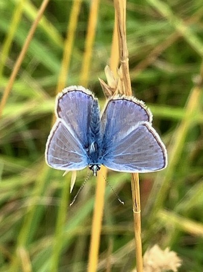
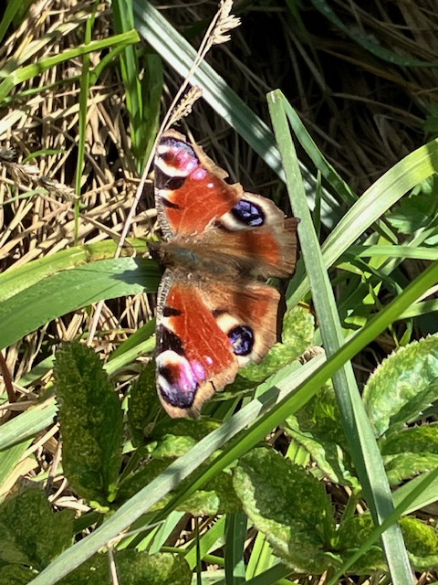
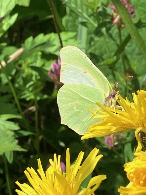
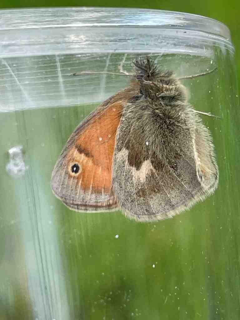
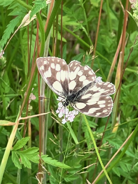
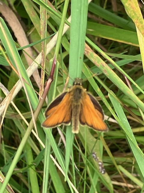
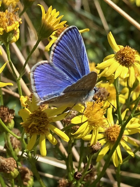
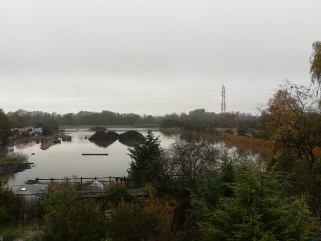
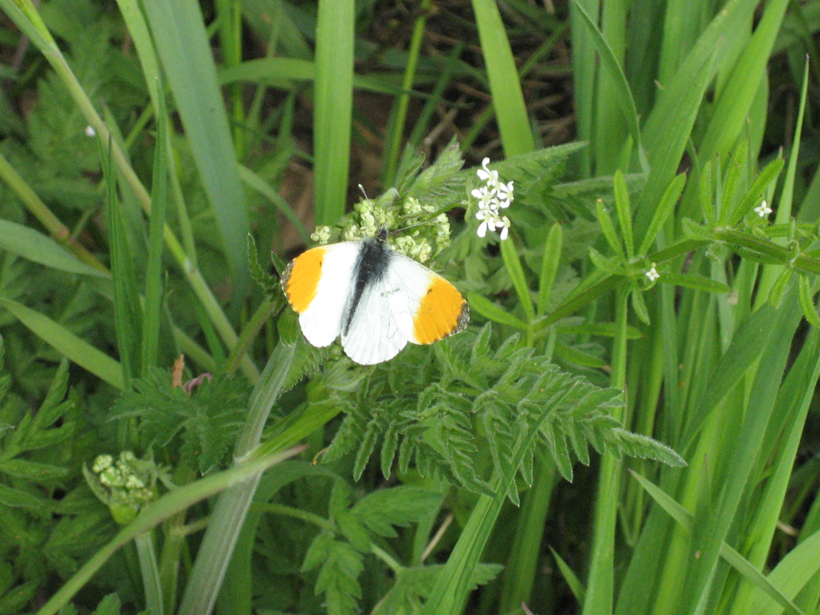
As part of our commitment to ensuring the Oxford Flood Alleviate Scheme delivers a benefit for wildlife we have continued to survey butterflies in the Oxford floodplain this year. A group of us take turns to record butterflies along a fixed route each week from 1 April to 30 Sept. The route, called a ‘transect’ , is registered with the UK Butterfly Monitoring Scheme. Our surveying follows the methodology set out by UKBMS and we submit data to it.

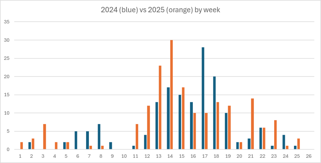
This year saw an increase in the number of butterflies recorded compared to 2024 which was a poor year nationally. Also, many species emerged earlier than is normal because of the warm spring and summer. The number of species recorded was similar to last year, but with a few differences in the species list.

Numbers of butterflies recorded by week 2024 vs 2025

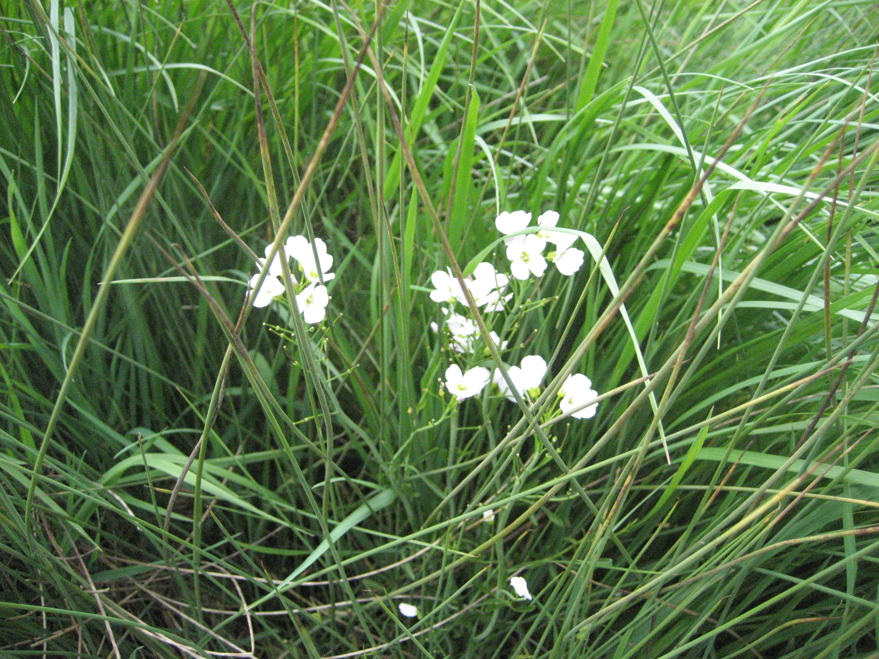
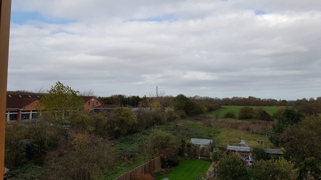
The transect is divided into six sections each of which represents a different type of habitat. The main difference in results this year was the big increase in butterflies recorded in section2, along the southern edge of the Bulstake Stream just south of Osney Mead. Most of the butterflies in this section were recorded in areas close to telegraph poles and a hedge where the grass was not cut all year. This suggests that a different management of the meadows, with some areas left uncut, would boost butterfly numbers.

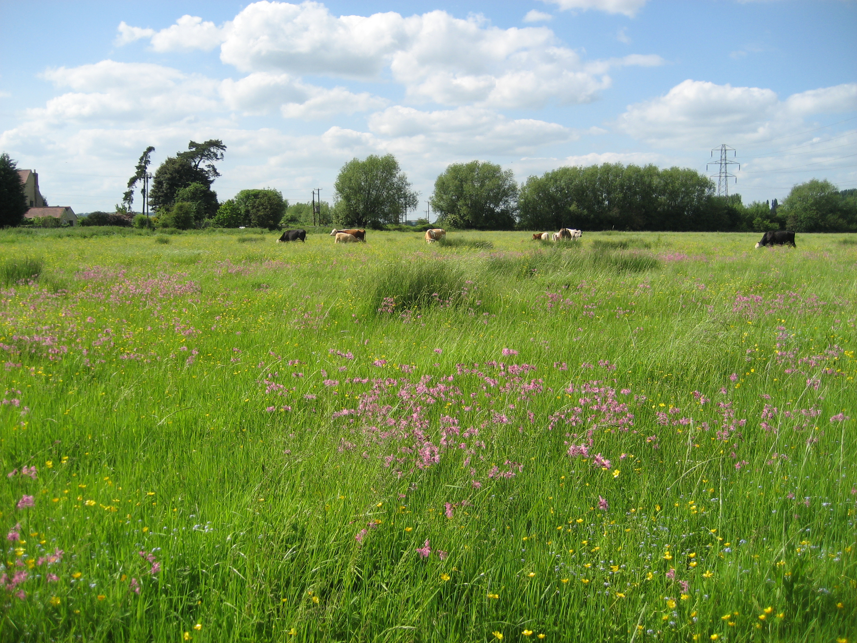
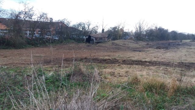
The grass in the meadow was mowed three times this year, with an impact which can be seen in the low numbers in section 3. Sections 5 and 6 are scrub and meadow at Hogacre Eco-park were we see the highest numbers and a greater range of species.

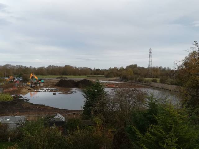
This data has been shared with the Environment Agency with whom we are talking about ways to enhance butterfly numbers as they acquire land for the scheme (sections 1-3), begin to manage it differently, and plant more hedgerows and trees. We also share our data with the Hogacre trustees with whom we collaborate.

We have access to data from transects at Chilswell Valley, across the A34 from South Hinksey, and Oxford University Farm at Wytham. Butterflies are far more abundant on these other transects compared with the floodplain, which again suggests significant room for improvement.

A Common blue butterfly

Tracking future biodiversity trends

As part of OFA’s commitment to improving biodiversity in the west Oxford floodplain, steering-group member Simon Collings has been recording butterflies in the area. In 2023 he carried out a survey of species present in the floodplain and shared the results with the Environment Agency ecologists working on the Oxford Flood Alleviation Scheme. This year (2024) Simon set up a transect under the UK Butterfly Monitoring Scheme (UKBMS) . He and two volunteers conducted weekly surveys from April to September. Results have been shared with the EA.

The 1 km transect route starts on the Electric Road near Osney Mead, follows informal paths across the meadow to the south of the Bulstake Stream, and finishes at Hogacre Eco Park. The route was planned with the directors of the Eco Park, and with the EA ecologists.

Why is OFA doing this?

‘The idea was to establish a baseline prior to the EA building the flood alleviation scheme,’ Simon explains. ‘I knew from surveying in 2023 that Hogacre is relatively rich in butterflies. The Hogacre trustees are keen to gather more data on biodiversity at the site and the formal methodology of the transect helps provide some of that. The first three sections of the transect, in contrast, are across land where the EA will be introducing improved species-rich grassland, hedges and trees. Over time the butterfly population here should increase.’

This year has not been good for butterflies, with numbers down hugely across the UK. This is reflected in the results obtained locally compared with Simon’s observations in 2023. A total of 161 butterflies, representing 18 species, were recorded along the transect. Of these 122 (76%) were in the scrub and meadow at Hogacre. The most commonly recorded species were meadow brown (48) and gatekeeper (45).

How does it help improve biodiversity?

The transect methodology gives a measure of relative abundance which can be compared with other sites and which can be tracked annually to show increases or declines in populations and species. Butterflies are highly sensitive to changes in the environment and for this reason are used nationally as an indicator of environmental health.

Surveying on the transect uses a precise methodology and the records submitted to UKBMS are checked by an expert. Simon’s 2023 sightings were submitted to iRecord where again records are verified by experts.

‘OFA sees the biodiversity elements of the flood alleviation scheme as an opportunity to support wildlife in the area,’ Simon says. ‘To maximise this we want to engage local people in citizen science and conservation activity, working in partnership with the EA.’

Landowners in the area, including some Oxford University colleges, are already involved in floodplain-meadow restoration. There are a lot of resources in the city to draw on. OFA believes we could create something significant here which connects up with other biodiverse areas in the county. The river system is an obvious wildlife corridor.

Simon is a member of Butterfly Conservation and also records on a 4.5 km UKBMS transect at Wytham run by the Centre for Ecology and Hydrology. More information on butterflies at Hogacre can be found here.

County ecologist supports OFAS biodiversity plan

Beccy Micklem, Landscape and Nature Recovery Team Leader at Oxfordshire County Council has confirmed that she is now satisfied the OFAS scheme can meet its targets in relation to biodiversity net gain. This follows the submission of ‘letters of comfort’ by the Environment Agency and three landowners confirming that land is available to provide offsite biodiversity compensation.

Ms Micklem’s updated response to the case officer says: ‘Following delivery of off-site habitat creation, the scheme will result in net gains of 11.24% area habitats, 11.66% hedgerows, and 15.22% watercourses. Provision of letters of comfort from landowners with whom the applicant is engaging with regards delivery of offsite BNG (Blenheim Estate, the Earth Trust and Oxford City Council) have recently been submitted, providing increased certainty that the necessary provision of offsite BNG will be deliverable.
Should you be minded to grant planning permission, a number of planning conditions and obligations will be needed to secure measures to conserve biodiversity and deliver a net gain.’

The document goes on to set out the specific conditions which should be attached to planning consent. This would appear to unblock the final obstacle to the scheme securing planning permission. We are hoping the application will now go to the 3 June meeting of the County Council planning committee.

The updated response and the letters of comfort are on the County planning portal.

A mistake

While we wait anxiously to see whether homes, businesses and roads will flood, work on the City Council’s extension to its Seacourt Park & Ride has come to a very wet standstill.

Building a car park in a flood plain is not sensible. Work having started as the wet winter season approached, the site is now a lake and work has stopped. The JCBs have been withdrawn onto the higher ground of the existing car park, and heaps of building materials are abandoned in the water. If the construction had been completed much of the extension would currently be under water. All this while the City is on ‘only’ a Flood Alert, the lowest category of concern.

The construction costs are likely to be much higher than estimated because of the disruption caused by flood events of the kind we’re currently witnessing. Councillors ignored the reality of frequent flooding here when they approved the planning application, and now we’re seeing the consequences. The last official budget figure we’re aware of was around £4million; we have heard, from a usually reliable source, that the cost may have risen to around £6 million, even before the present flooding of the site. Is this a sensible use of tax payers’ money?

Flooding at the site began on  Monday, so it’s already been a working week that it would have been out of action if it had been built – that means lost revenue and an unreliable service. And time and money would then be needed for pumping out, clearing up and very likely making repairs before the extension could be safely reopened to the public. Further expense and further loss of revenue. Because the site is so low-lying, this will happen quite often.

Because it’s a car park and not a field there is increased risk to the public and to vehicles, and it remains to be seen how well the Council is able to manage flooding here. The water came up quite quickly at the start of the week, and in the interests of safety the extension would have had to be closed before that to avoid cars getting trapped in flood water, i.e. sometime early last week. And remember we are only on a Flood Alert, not a Flood Warning. Were people to try to enter even quite shallow floodwater to retrieve their cars things could go horribly wrong.

In the second photo above, from yesterday, you can see two large pipes floating in the lake, one in the centre, the other far over to the right against the boundary fence. If the flooding worsens these could float downstream and jam under the nearby bridge under the Botley Road, exacerbating flood risk. Were it already a car park, for pipes read cars.

We, and many others, fought this ill-conceived project hard. We hope the City Council will even now abandon it and restore the site to its previous state, as a valuable wildlife habitat, including for the badgers who have been driven out. To press on regardless means wasting ever more of Oxford’s citizens’ money, putting off for years any possible financial return to the Council, and meanwhile potentially both increasing flood risk and posing a risk to life and vehicles.

Upcoming talk on OFAS and wildlife

There is to be a talk, open to all, on ‘The Oxford Flood Alleviation Scheme: Maximising the benefits for people and freshwater wildlife’ with Jeremy Biggs of Freshwater Habitats Trust and Penny Burt from the Environment Agency on Monday 26 November 2018 at 6.30 pm in South Hinksey Village Hall.

Saving Oxford’s freshwater habitat: FHT and OFAS

The Oxford Mail today carries an article about the Freshwater Habitats Trust’s (FHT) very positive involvement with OFAS:

Freshwater Habitats Trust is Saving Oxford’s Wetland Wildlife

Much more on FHT and OFAS here:

freshwaterhabitats.org.uk/projects/saving-oxfords-wetland-wildlife

OFAS and development

Development

People have suggested that the Oxford Flood Alleviation Scheme (OFAS, the Scheme) could lead to, or facilitate, new development in the flood plain, which would add to urbanisation and reduce the amount of open space in west and south Oxford.

OFAS is about reducing flood risk to existing properties, business and infrastructure. It is not being proposed with the goal of creating opportunities for future development. There are a few areas which would benefit from the scheme where some development or redevelopmentmight take place in future, subject to the normal planning approvals being obtained. But this is incidental to the flood scheme.

Osney Mead

One of the areas where it’s claimed development will be facilitated is Osney Mead. Oxford University has publicly said that it has aspirations to redevelop this area. It is an already developed site, hosting a large number of businesses currently facing risk of flooding.

The University are paying for an additional bund (and all associated costs) to be created along the western edge of Ferry Hinksey Rd. This additional feature will increase protection from flooding for businesses currently operating from Osney Mead, and has been taken on board by OFAS for this reason alone. Any redevelopment would be of a brownfield site. Proposals for redevelopment would have to go through the planning process, demonstrate consistency with the existing Local Plan, and show they do not increase flood risk.

Elsewhere

The main area in the flood plain that is not presently built on, but which will be protected by OFAS from flooding in future, is on the river (east) side of the Abingdon Road, south of the hotel and including University College sports ground and Cowmead allotments.

This area (about the size of Osney Mead) will be protected by a bund along its eastern edge. We understand it would be very difficult, and more costly, to put the bund closer to the road. But even with the current OFAS design there is no certainty that this land will be developed.Any plans to develop these sites would be subject to local planning permission, and while OFAS could make the conditions easier to meet, it does not follow that development will happen here.

The vast majority of the flood plain will continue to flood – and that will be essential for the Scheme to work as planned. Although the Scheme area, where changes will be made, does not occupy all the flood plain meadowland, these flood meadows are nevertheless an integral part of the scheme design and need to be able to flood as they do now.

There will be no change to the Green Belt around Oxford as a result of the construction of OFAS.

The open, green flood plain meadows will be no more open to development than they are now, indeed arguably the fact that they will now be part of a specific, designed and paid-for flood scheme will make development there much less, not more, likely.

And if, as intended, the scheme area is expertly managed for wildlife, by organisations such as the Freshwater Habitats Trust or BBOWT, as well as for recreation (including fishing), the greater its chance of resisting the threat of unscrupulous developers.

There are other recent posts relating to OFAS –

Clarifications and explanations

Gravel mining – Be careful what you wish for

An Oxfordshire gravel mine, 2018

OFAS: Environmental meeting

OFA attended a briefing yesterday (22 May 2018) on the Environmental Statement which forms part of the OFAS planning application. This was organised by the Environment Agency (EA) specifically for local environmental groups. Penny Burt, Phil Marsh and Graham Scholey for the EA covered different aspects of the scheme, and provided updates on the various environmental assessments being conducted.

The scheme will result in the creation of a continuous area of marshy meadow either side of the new channel with various scrapes and ponds to enhance the habitat value. Overall biodiversity should be improved and strengthened.

But there are downsides. Rich grassland meadow in some areas will be lost, and while there are plans to create more of this habitat elsewhere in the scheme this is not without risk. Trees will be lost in some areas, though compensated for elsewhere. Some views will change significantly, e.g. along Willow Walk, and at Kendal Copse just north of Kennington.

Several useful comments were made by participants in the meeting about ways to enhance environmental benefits from the scheme which the EA will think about.

Ongoing effective management of the project will be critical and the Environment Agency is now exploring detailed proposals around this with various local wildlife organisations. OFA welcomes the idea of collaboration between the EA and local bodies, but is arguing that whatever arrangements are set up there needs to be a mechanism of accountability to the public, so that local interested parties can understand what is being undertaken, and what achieved – both for flood relief and for wildlife.


Seacourt and wildlife

The site for the proposed extension of Seacourt Park and Ride is designated under the Oxford Biodiversity Action Plan (BAP) 2015-2020.  This is ‘An overview of actions to support biodiversity in Oxford City Council’s own estate and operations.’ Under this plan the Seacourt proposed extension site is designated as

  • a Conservation Target Area
  • a Habitat of Principal Importance.

It’s important habitat for many species including several badger setts. But, before the matter has even been before a Planning Committee for a decision, the City Council has cleared  the area over the last week or so. The pictures tell the story. What a sad disgrace.

See too http://www.oxfordmail.co.uk/news/15698598.Council_accused_of_starting_work_on_park_and_ride_before_getting_planning_permission/

EDIT: and this recent video by the Oxfordshire Badger Group